
Where to go
The Red Warm Current over 2,000 ft. a.s.l
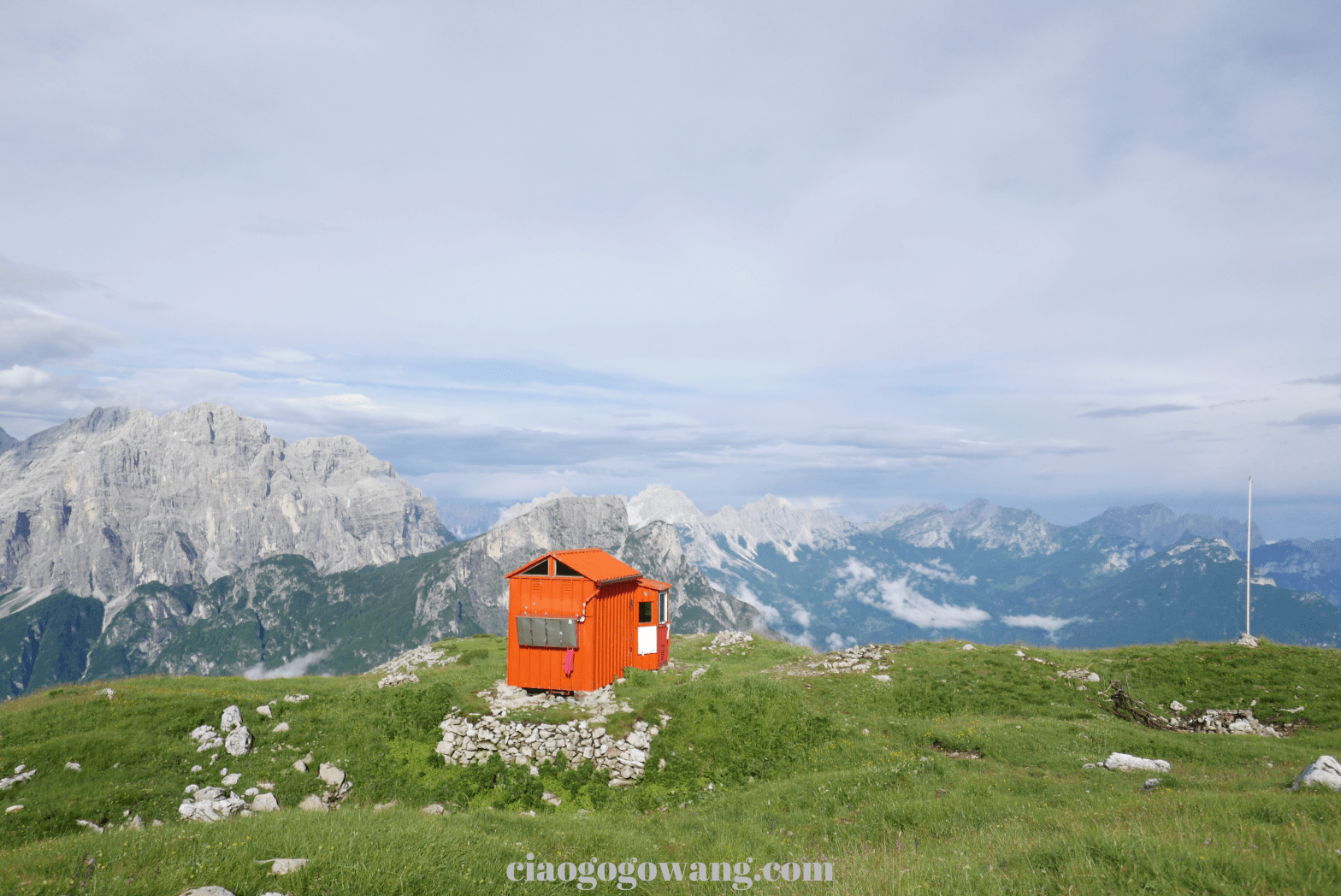
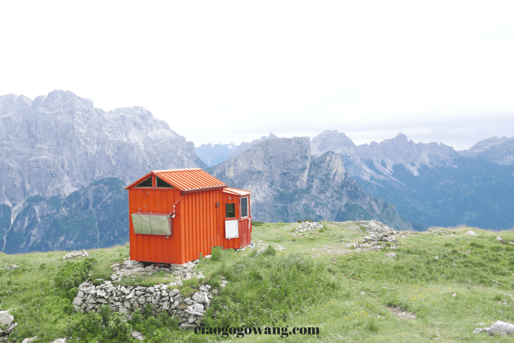
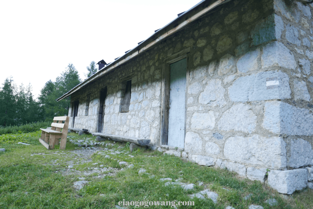
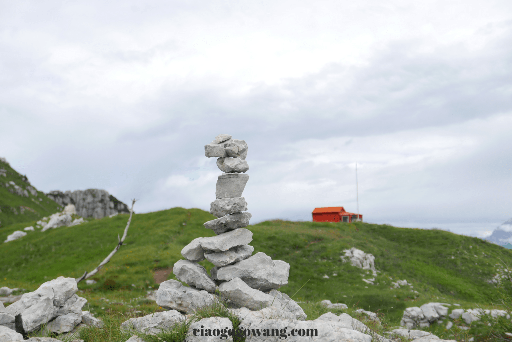
【Bivacco Bedin】
There is a magnificent mountain range “Dolomiti” in the north of Italy, which is a well-known ski resort in winter and a popular hiking paradise for mountaineers in summertime. The endless mountain range creates unforgettably beautiful scenery, especially in summer when walking on the mountain trails feels incomparably isolated, and the dazzling sunshine reflects on the stone walls of the forests, which gather the natural souls of Italy, France, Germany, Austria, Switzerland, and other countries together, and has the status of a World Natural Heritage Site.

Nestled among the peaks and overlooking the Dolomiti
That beautiful but lonely Red hut [ Bivacco Bedin ]
A campsite that even most Italians don’t know much about.
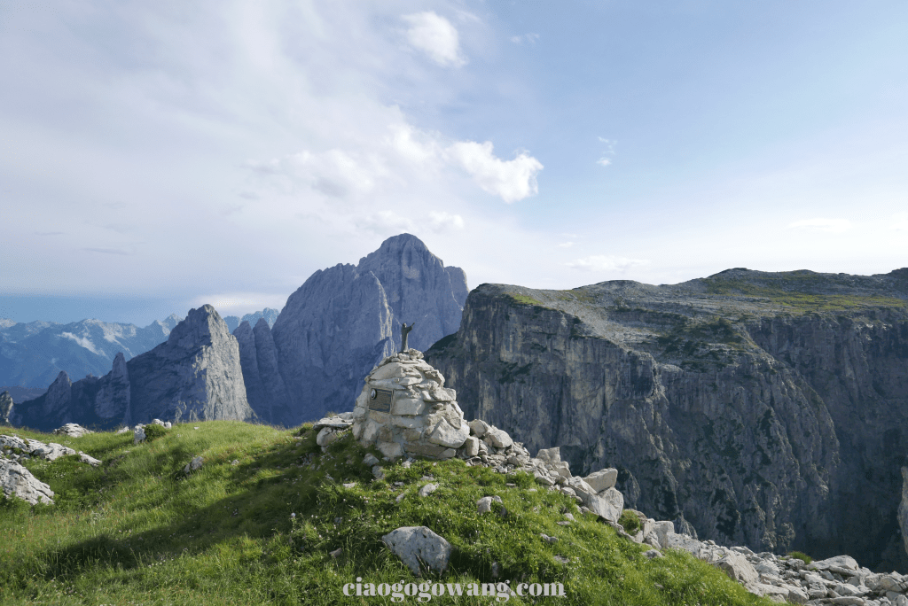
The Bivacco Bedin is located on a green plateau at an altitude of 2,210 ft. above sea level in the Pale di San Lucano. The area is famous for its magnificent peaks, grandiose mountain ranges, and spectacular natural landscapes. Originally built in 1977 by the Italian mountaineering group called Vicenza, in memory of one of their members Margherita Bedin, who died tragically on Gran Sasso Mountain. The hut is a simple and sturdy structure that offers climbers a place of rest and refuge away from the hustle and bustle of the city, with unparalleled panoramic views of the nearby mountains, cliffs, and valleys.
▌Information ▌
| Starting Point | Pradimezzo, Cencenighe Agordin 870 ft. | Difficulty Level | Medium/High (recommended for experienced climbers) |
| Trail Type | Intermediate | Mountain Range | Pale di San Lucano |
| Map Trail | CAI 764 / 765 | Altitude Difference | 1,400 ft. |
| Trail Type Ecology | Uni-directional access | Time Required | 5-6H |
| Altitude (above sea level=ASL) | 870- 2,210 ft. | Best Season | Spring, Summer, Fall (Winter snow season can make paths impassable) |
| Pavement Condition | Dirt track, rope pulling, debris, crumbling walls | Apply for Entry | unnecessary |
▌Bivacco Bedin Environment ▌
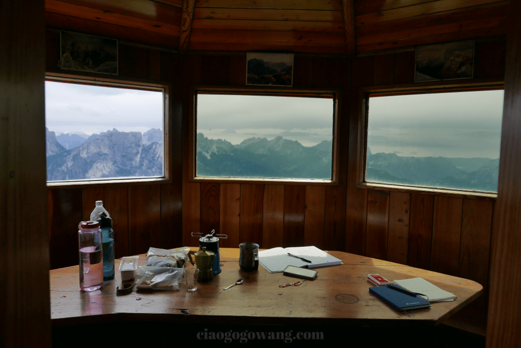
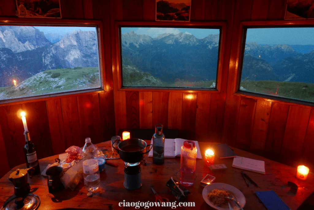
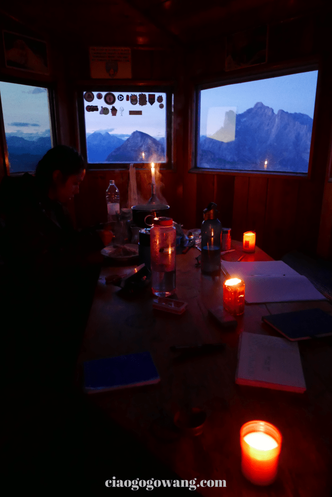
▎Bivacco Bedin ▎is a wooden structure made of two multi-sided geometric shapes, covered in customized metal panels, with windows that look out to the east and offer a breathtaking view of Dolomiti from inside the hut. The metal panels on the outside of the window frames can be manually covered in anticipation of the changing weather situations on the Peak, also allowing the hut to achieve a good protection mechanism and at the same time keep the indoor room warm when the temperature is low outside.
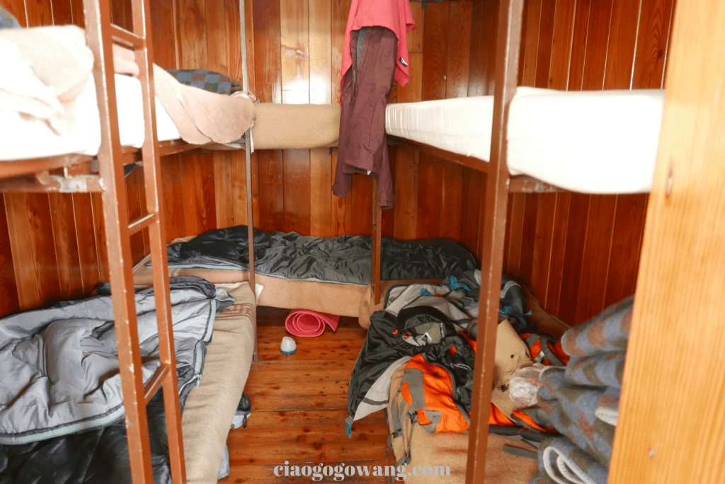
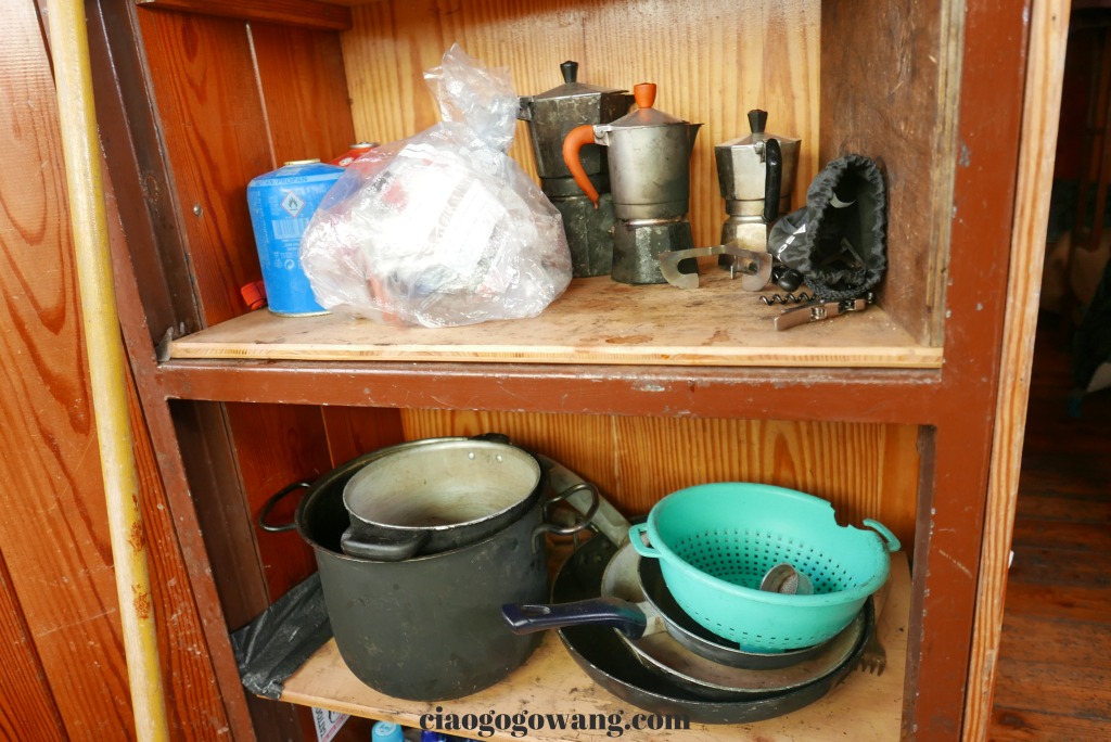
The interior is divided into two areas, “sleeping” and “public“, using wood as the main material. Sleeping environment, with nine beds to utilize the limited space effectively, each bed is equipped with warm blankets labeled in the direction of the head and feet, even if a boy who is over 180cm still could have a good rest. In the main public space, there including wooden polygonal table, wall benches, and built-in cabinets, on top of which there are materials and equipment contributed by mountaineers. Outside the house even added a rainwater tower, which can be used for emergency water is very convenient. A seemingly narrow building structure but has all the essential stuff that you need on the mountaintop.


▌Backpack △ What to prepare ▌
Backpack 1:40-liter backpack, camera, sleeping bag, water, spare clothes (warm jacket, long-sleeved top, underwear, socks), food (fruits, brewed stew packs, tea, cola, sandwiches, biscuits), snakes (bananas, chocolate milk, dried fruits, candy), sandal, and garbage bag.
Backpack 2:60-liter backpack, sleeping bag, water, hiking stove, gas canister, spare clothes (warm jacket, long-sleeved top, underpants, socks), food (fruits, ham, bread) notebook, snakes (biscuits, bananas), and garbage bag.
▌Unexpected Mountain Hut △ How to go ▌
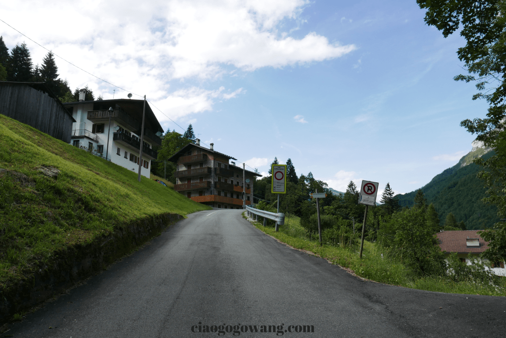
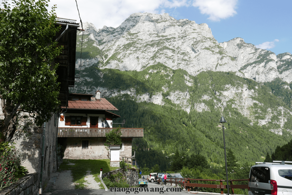
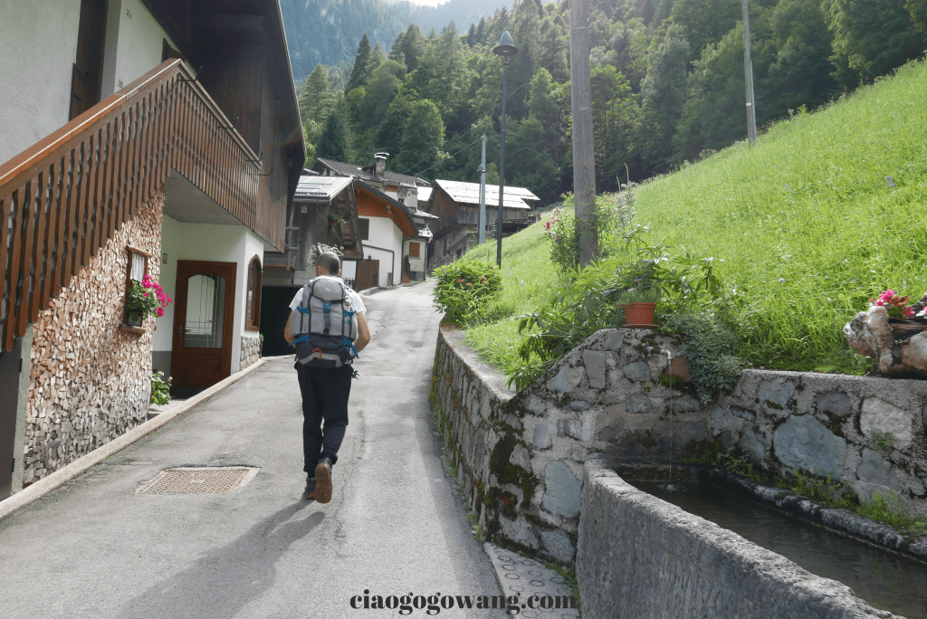
We heard about this magical place from an 18-year-old Italian boy Alessio, after he highly recommended us to go there. we drove from Lago di Garda to the village of Pradimezzo, Cencenighe Agordin.
However, it was already past 4pm when we arrived, but since the weather report expected that there would be heavy rains that night, our simple tent would not be going to be able to withstand the situation, so in the end, we decided to head up to the mountain to avoid the worst weather.
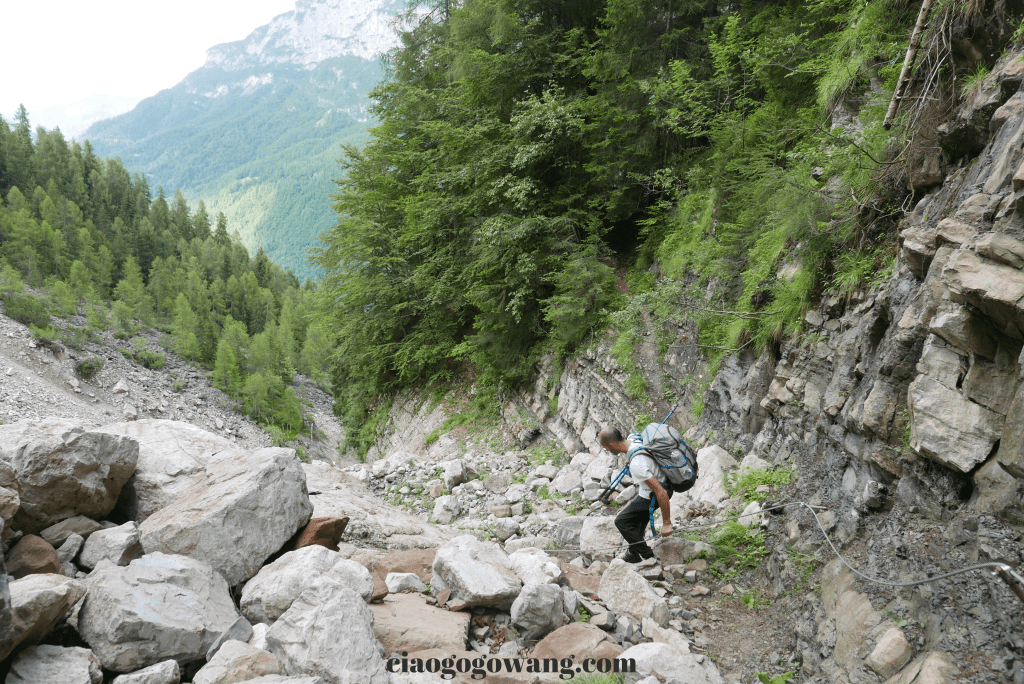
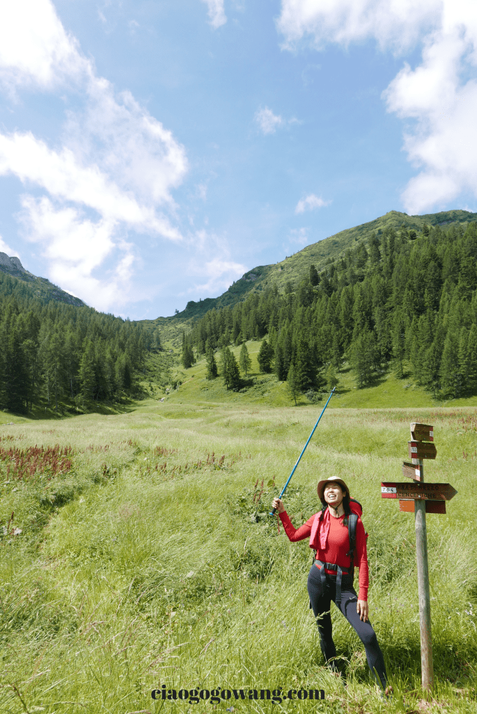
Basically, the whole route was along Route 764 (Ambrosogn) and then connected Route 765 to Bivacco Bedin. We parked the car at the spot reserved for mountaineers (873 meters above sea level) and quickly packed up the necessary gear and supplies, and then we started to climb the mountain at around 5:00 p.m.
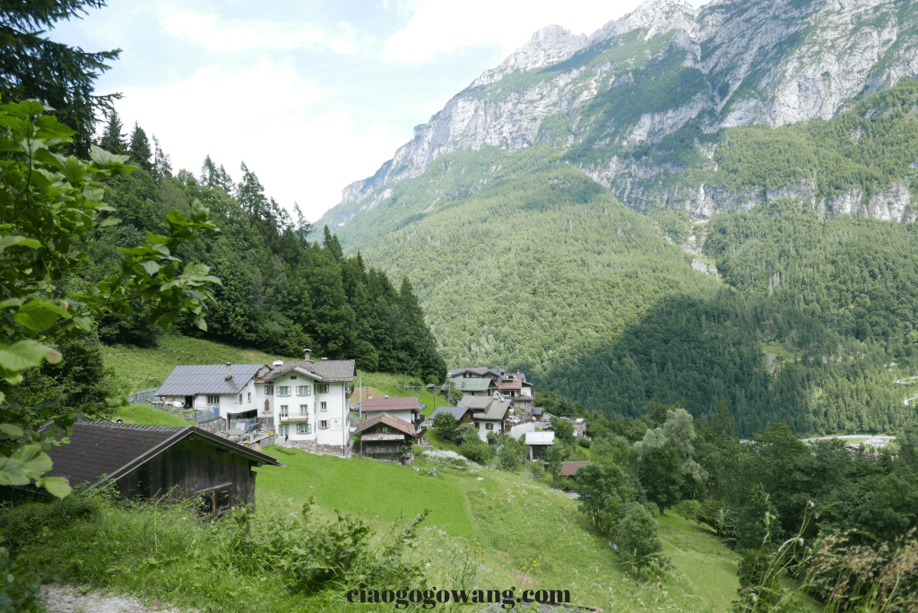
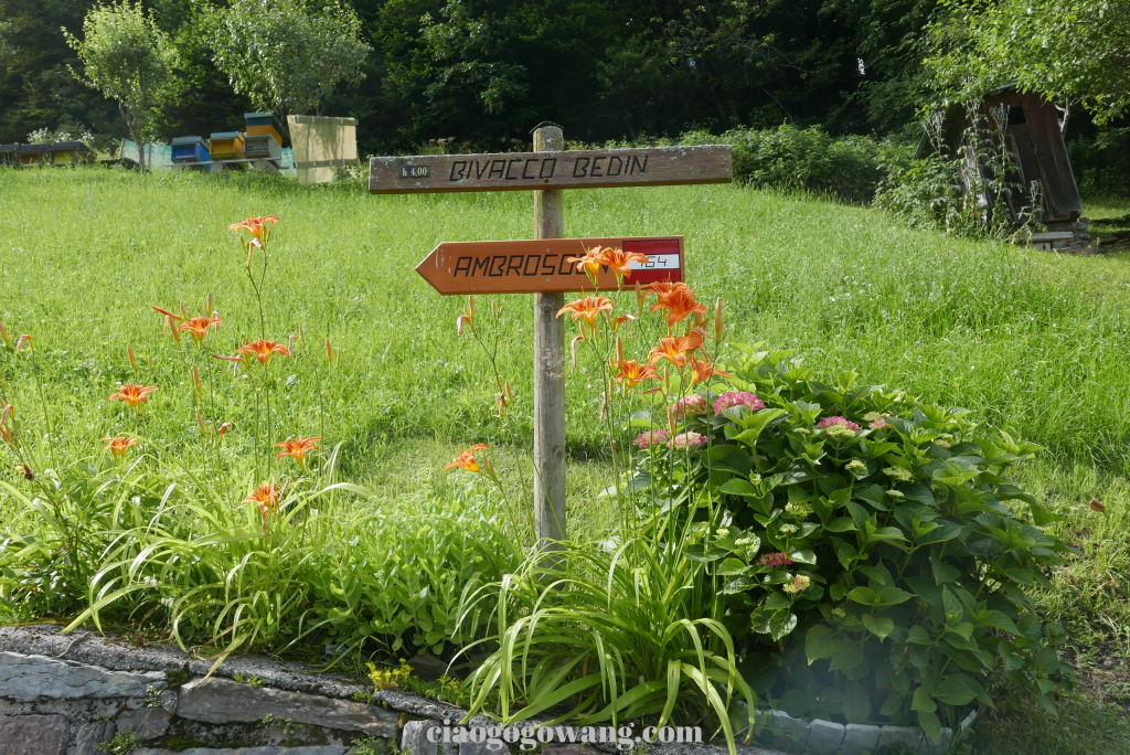
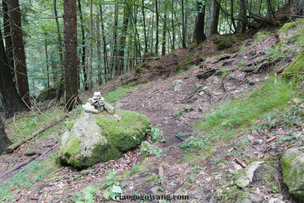
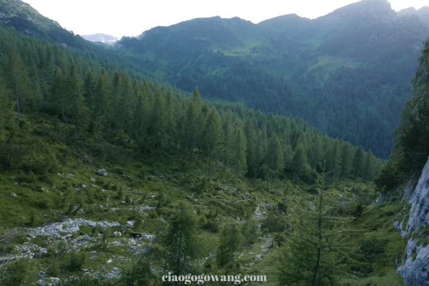
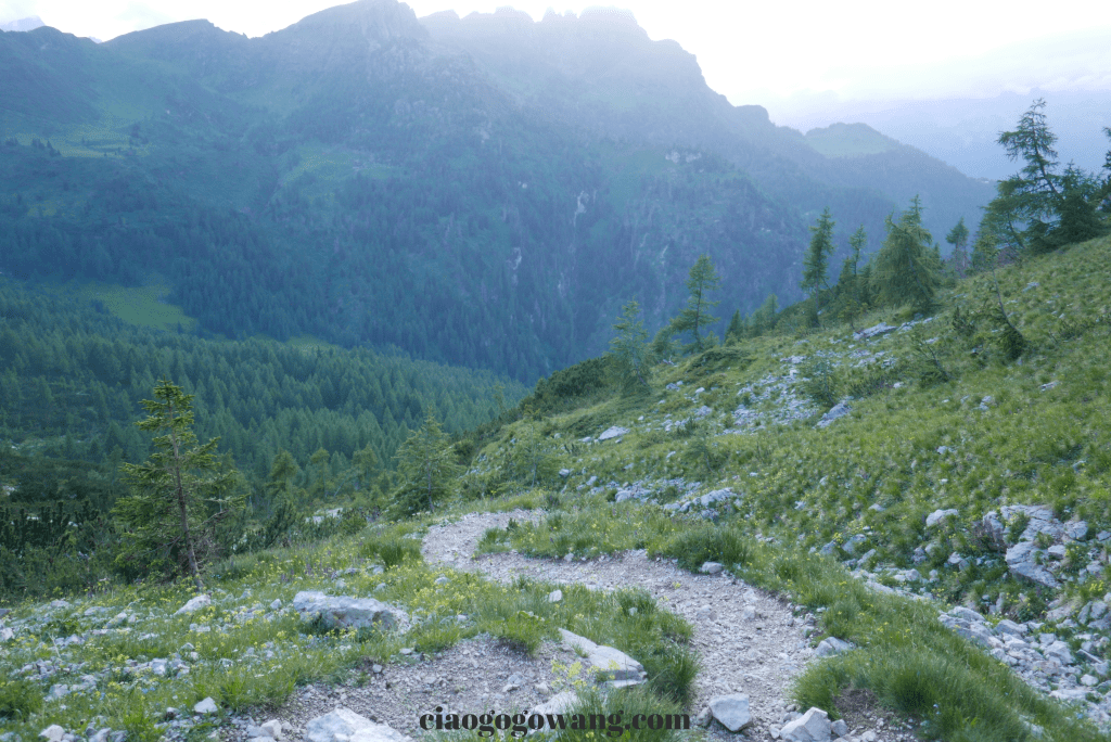
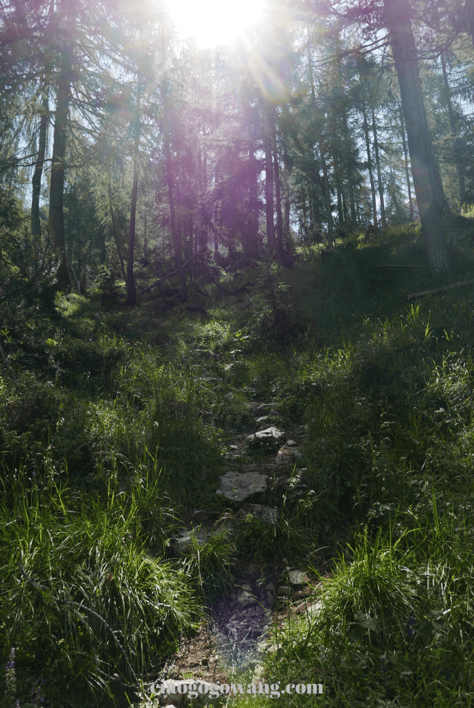
After passing through the village, the fork signposted n.764 (Ambrosogn) to the right, officially entered the multi-bends forest. luckily the late departure helped us escape the heat of the afternoon in comfortable weather that didn’t make us sweat all over our backs. The first 30 minutes were a quick warm-up, and the rate of breathing became more and more rapid for the climb around 1,400 ft.
Along the way, follow the red and white signs (a common sign for hiking routes in Italy), and occasionally you can see some small towers pushed up by rocks to assist hikers of the right direction.

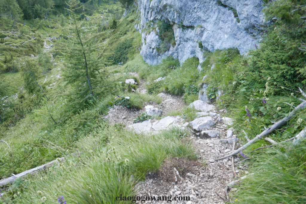
After about an hour, the trail starts to cut down to the stream way (Rù del Torcol), which used to be connected to the wall by a suspension bridge, but a natural disaster in the fall of 2018 destroyed the bridge, only leaving some remains of a broken bridge, now it is necessary to carefully pass through the rocky rappel to continue the ascent.
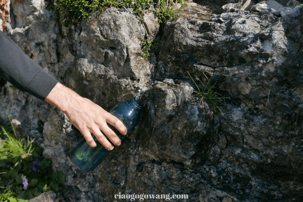
Before passing the Malga D’Ambrosogn ranch, we would first pass an overgrown building (Casera del Torcol), and a well-maintained water point (the other location is about 20 minutes walk from the Bivacco Bedin), where we rehydrated and change out of our soaked clothes.


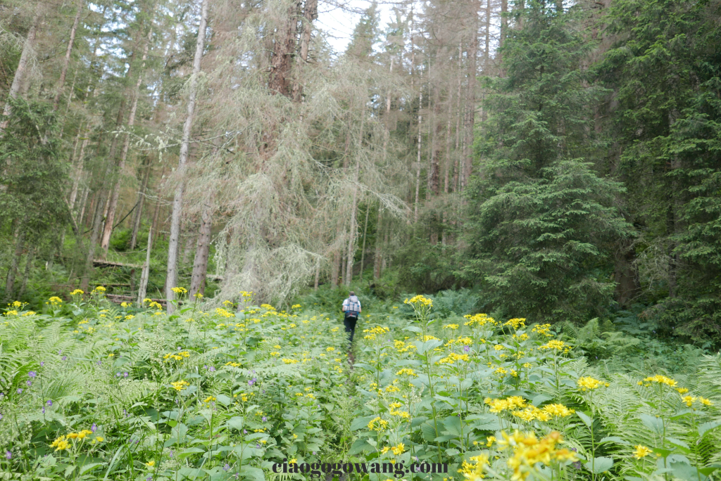
From the cool forest through the soft meadows and along the wide Val del Torcol, it takes an hour to reach the charming green basin of Malga D’Ambrosogn, which was renovated in 2009 and is being used as a campsite, where you can still see some hikers camping here time by time.
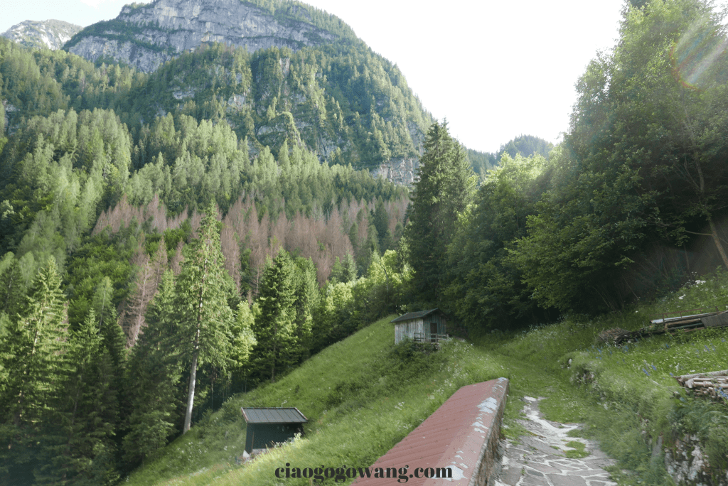
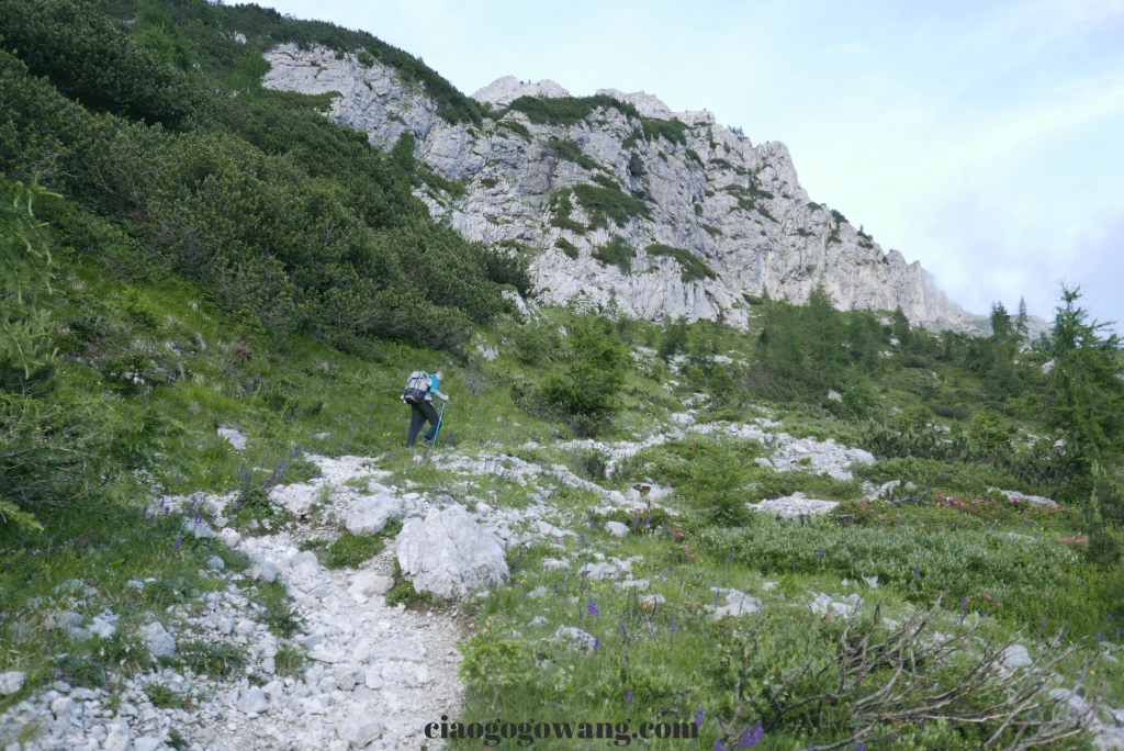
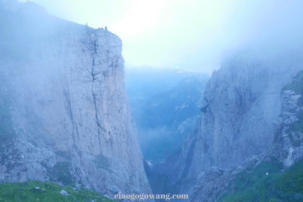
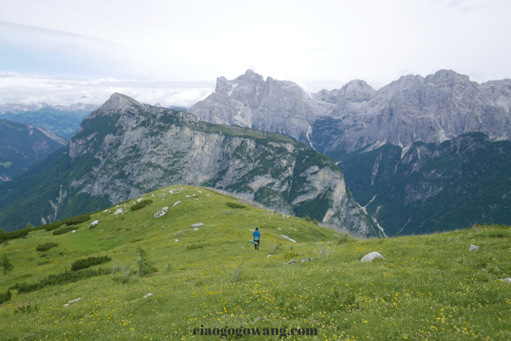
After leaving the deciduous forests, the vegetation became thinner and thinner, and as we entered Route n.765 we started to climb steeply up the gravel road, up over the sidewalk of Cime di Ambrosogn, and as the sky darkened with mist, we couldn’t help but scared that we would be walking up the mountain in the dark.


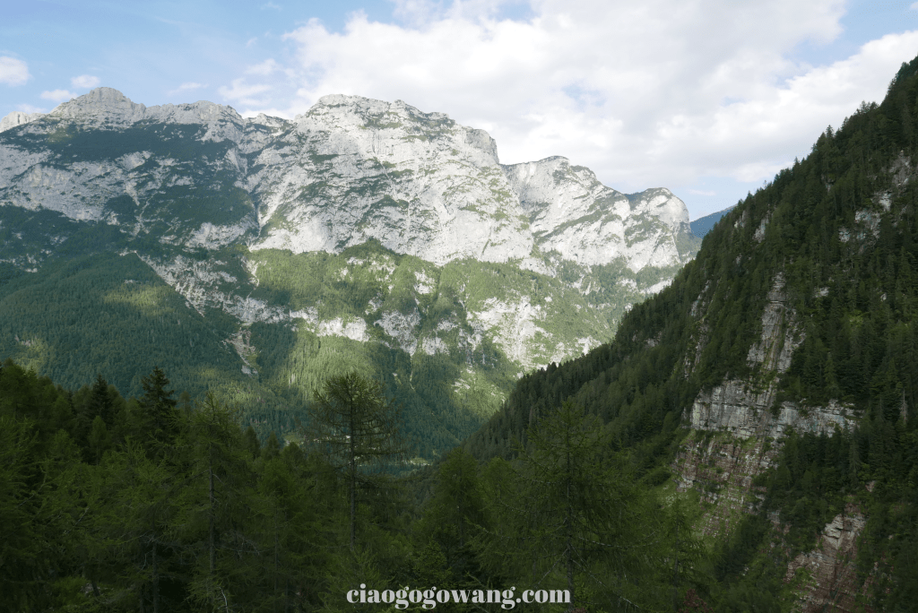
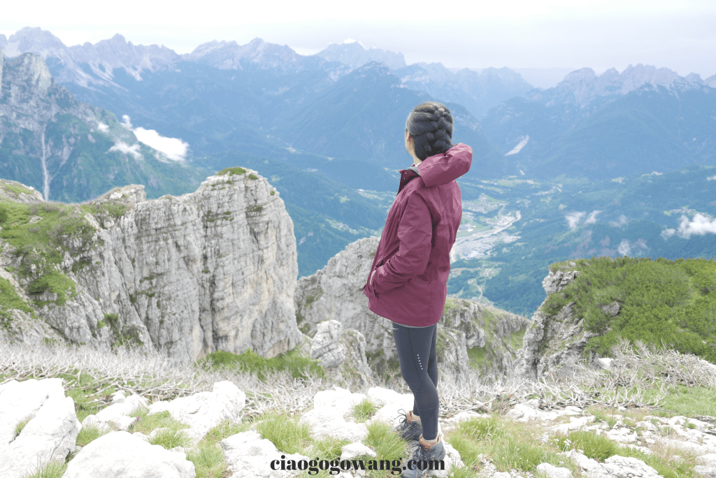
The climate in the mountains was so unpredictable that we didn’t dare to stop for a rest, fearing that we might encounter fog at some point. Instead, only can walk along the perimeter of the precipice, looking back from time to time at the breathtaking views of Monti del Sole and Valbelluna without being able to stop and admire them. Little did we realize that we were not far from our destination!
From here, we follow the winding southern face of the Prima Pala di San Lucano, the first altar of San Lucano, to the last section before the fog comes in, and at 9.30pm we reach the coveted finishing point: 【 Bivacco Bedin 】, situated on the high plateau of the Prima Pala, at an altitude of 2,210 ft., an excellent panoramic view, where you can stay overnight in a mountain hut, just as we did, or you can camp around the area for the night. In addition to staying at the hut like we did, you can also set up camp for the night in the surrounding area. (There were only two of us and two other young men and women in the hut that night.


Through the age-old photos on the wall, you can see the lonely but energetic Bivacco Bedin in spring, summer, fall, and winter, standing at the top of the mountain to provide shelter for the countless hikers, accompanying them every day.
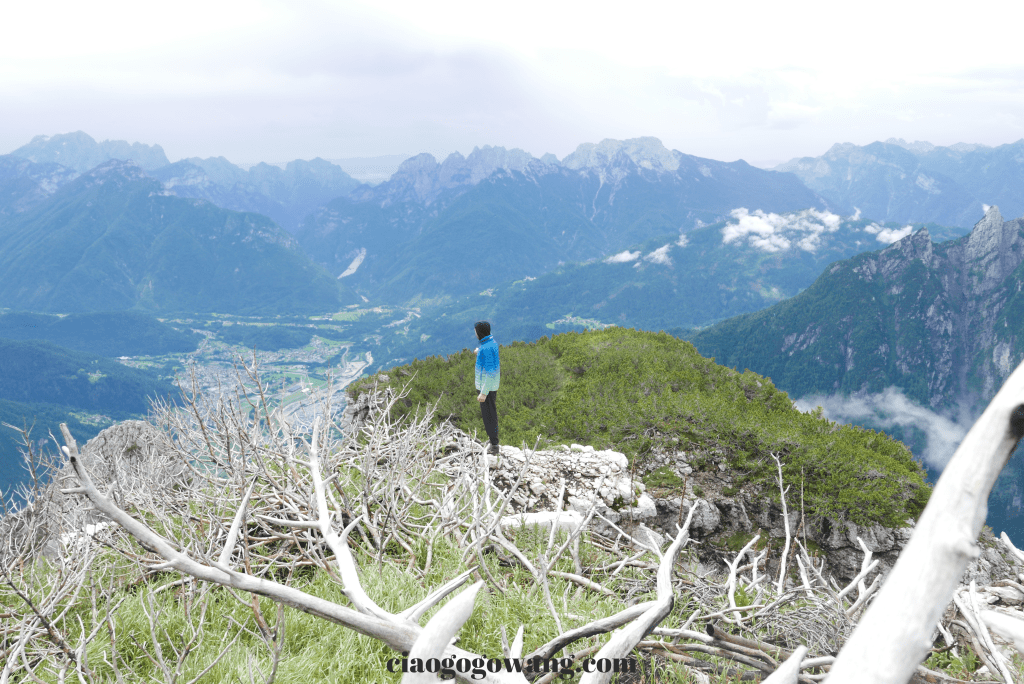
We stayed on the mountain for two nights in total and encountered a variety of weather conditions. Being at the top of a cluster of mountains, the air currents mostly converge up the mountain walls, therefore, the thunder and lightning combined with the heavy storm on the first night made it difficult for all of us to fall asleep. On the second day, a short period of sunshine gave us a chance to explore the surrounding scenery and discover another trail that had been destroyed by an accidental fire, leaving behind a patchwork of gray and dead branches creating a distinctive look, with some beautiful flora and fauna that can only be found at high altitudes.
Under the warm and cozy temperature, we had yoga on one of the gentle stones, trying to get rid of the recent heavy stress and the high level of exercise on the first day. There was a thunderstorm + hail in the afternoon, and the rain brought away the clouds in the sky, giving us a chance to see the stars in the sky at night, even though the temperature was low, there was no way to stop the emotion brought by the bright starry sky.
On the day of the descent, I tidied up the hut took away the garbage, and rushed to leave before 10:00 a.m. I met two groups of 9 people in the middle of the journey. Although the descent was not as tiring as the ascent, the inclined gradient of the wet and slippery path required a high degree of concentration, and the carelessness of slipping and falling brought an immense amount of pressure on my knees and feet, and it took the same amount of time as the ascent (about 4.5 hours).
The lack of physical support during the endless climbs on the mountain hills brought me more and more discouragement and demoralization, but luckily my partner gave me great support and encouragement so I could make it to the top and cleanse my body mind spirit.

For those who love to explore the mountains and forests, it is recommended that you don’t miss out on this beautiful place and make sure to arrange a visit to Bivacco Bedin when you are in Dolomiti to experience a different kind of scenery.
▌Thoughtful Notes ▌
Regarding the contents of the backpack, because we were in a hurry we didn’t take photos of what they looked like. If you plan to spend a night in the mountains, we suggest you choose a lightweight medium-sized backpack (26-40 liters is more than enough) but if you want to camp there then you should include the weight of the tent. Don’t need too many items for the trip in summer and fall, if you have limited physical abilities just bring enough water for rehydration because there are two places where you could replenish the water supply.
There is no electricity supply in the hut, so everyone spontaneously prepares “candles” but we recommend you to use rechargeable headlamps, and “coffee powder” (Italians are famous for their love of coffee, and there are mocha pots left behind by former hikers so that future hikers can easily quaff a hot cup of coffee).
Last but not least, as the old saying goes, take your own garbage down the mountain【No Trace in the Mountain Forest】! Remember, we have to pay attention to maintain the beautiful mountains and forests to share with others ^^.
